Upgrade Your Wardrobe with American Map Essentials
Count on our American Map range for reliability and premium quality.
Political Map of the USA - Size A1-59.4 x 84.1cm - Paper Laminated
Blank American Maps: To Practice Labeling the 50 States of the United States & Capitals (Blank U.S. Maps)
KappaMapping Company United States Poster Size Wall Map 40 x 28 with Cities (1 Map)
U.S. Map Poster (32 x 50 inches) - Laminated: - a QuickStudy Reference Poster – May 31, 2013
USA States and State Capitals Map - A3 (30cm x 42cm) Childrens Wall Chart Educational Kids Childs Poster Art Print WallChart
HISTORIX Vintage 1862 United States Railroad and Military Map - 18x24 Inch Vintage Map of USA Mexico West Indies - American Civil War Map Poster Wall Art - US History Map Civil War Print (2 Sizes)
USA Wall Map for Kids with Illustrations- United States Poster Map for Home or Classroom, (18” x 29” Laminated)
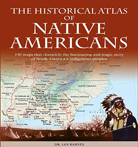
Historical Atlas of Native Americans: 150 Maps Chronicle the Fascinating and Tragic Story of North America's Indigenous Peoples (Historical Atlases) Paperback – Import, 16 July 2019
Palace Learning Laminated USA Map - 18" x 29" - Wall Chart Map of The United States of America - Made in The USA - Updated (Laminated, 18" x 29")
Palace Learning Laminated USA Map - 18" x 29" - Wall Chart Map of The United States of America - Made in The USA - Updated (Laminated, 18" x 29")
Fifty States of the U.S.A. Flags & Facts: Learn about All 50 American States. Illustrated Guide for Adults & Children with Capital Cities, Nicknames, Mottos, Population, Area, Anthems
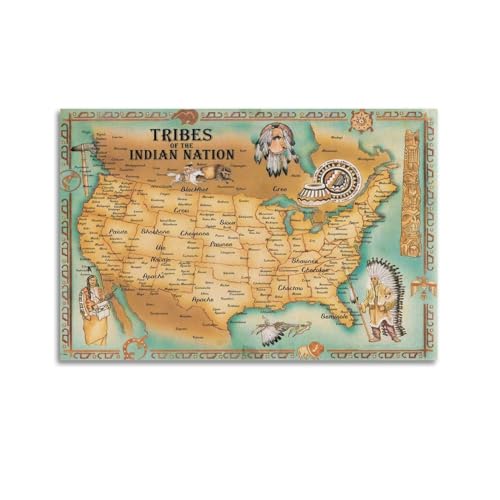
Riley Creative Solutions USA Native American Indian Tribes | Pictorial Map Wall Poster (3 Sizes) (16"x24")
Safety Magnets Map of United States for Kids - US Map with Capitals - American Map Poster - 50 States Map ,Laminated- 17 x 22 inches multicolor
Laminated World Map & US Map Poster Set - 18" x 29" - Wall Chart Maps of the World & United States - Made in the USA (LAMINATED)
USA Map Classic - Front Sheet Lamination - 86.4 (w) x 55.9 (h) cm
2 Pack - Laminated World Map Poster & USA Map Set - Equal Earth world map design shows continents at true relative size - US Map 18” x 29”
Close Up XXL USA Map Premium Poster - Giant America Map with all States 55" x 39" MAPS IN MINUTES
Lonely Planet USA Planning Map
British and American News Maps in the Early Cold War Period, 1945–1955: Mapping the "Red Menace" (Palgrave Studies in the History of the Media)
2 Pack - USA Map for Kids + Blue Ocean World Map (LAMINATED, 18" x 29")
24x36 United States, USA Classic Elite Wall Map Mural Poster (Paper Folded)
USA Map for Kids - United States Wall/Desk Map (18" x 26" Laminated)
North American Indian Cultures, Tubed: Wall Maps History & Nature (National Geographic Reference Map)
CRAFTWAFT ROLLUP MAP OF THE AMERICAN WAR OF INDEPENDENT (WALL HANGING,PIPE MOUNTED)
Historix Vintage 1861 American Civil War Map - 18x24 Inch Vintage Map of the United States Showing the Location of Military Posts, Arsenals, Navy Yards and Ports of Entry (2 sizes)
USA Map Poster - United States Map Chart [Green/Color]
32x50 United States Classic Premier Blue Oceans 3D Wall Map Poster (32x50 Laminated)
Map of USA 50 States with Capitals Poster - Laminated, 17 x 22 inches - Colorful Complete Map of United States for Children - North America, US Wall Map - Classroom & Homeschool
Antique Style USA Map - Wall Chart Map of The United States of America - Made in The USA - Updated (LAMINATED, 18" x 29")
National Geographic Maps: United States Contemporary Wall Map - Compact - 23.25 x 16 in - Paper
United State Map Laminated Poster -Double Side Educational Poster For Kids/Adults -18 x 24 inch Waterproof Map For Home Classroom
Momo & Nashi United States & World Map Poster for Kids - 2 Pc - 24 x 16 Inch Waterproof USA & Map of the World Poster - for Wall Posters for Learning, Classroom, Education, Back to School Resources
US and World Desk Map (13" x 18" Laminated) for Students, Home or Classroom Use by Lighthouse Geographics Office Product
48x78 Huge United States, USA Classic Elite Wall Map Laminated
Palace LearningUSA Map for Kids - LAMINATED - United States Wall Chart Map (18 x 24)
Large Scratch Off Map Of United States 23x16 inch - Hand Drawn Travel USA Map with Accessories - Laminated United States Map - Deluxe Visited States US Map for Home Decor - Cool Traveler Gift Idea
2 Pack - World Map Poster & USA Map Chart [Tan/Color] (LAMINATED, 18” x 29”)
24x36 World and USA Classic Premier 3D Two Wall Map Set (Laminated)
Jabihome 3D Wooden USA Map Wall Art, Wood United States Map with Push Pins, Gift for Him, US Map for Travel Gifts for Men, Office Wall Decor, White Elephant Gifts, Christmas Gifts for Him, Dad,
24x36 United States, USA US Executive Wall Map Poster Mural (24x36 LAMINATED)
Scratch Off Map of The United States – US Scratch Off Travel Map with 50 State Flags and Landmarks – Map to Track States Visited, Full Accessories Set Included, Gift for Travelers, by Earthabitats
NOWMAP AquaShield Double-Sided United States, USA Map Waterproof Poster 24x36 - Folded Edition with (Pin Stickers)
American Highways Wall Map - 22.75" x 15.5" Laminated
RMC Classic United States USA and World Wall Map Set (Signature Edition)
Swiftmaps World Premier Wall Map Poster Mural 24h x 36w
Scratch Off Map Of United States, USA State Scratch Sticker, Travel Map Gift Adventure Wall Poster For Kids Adults (States)
American Map Store Beautiful Wall Map of the United States of America - Classic Antiqued Atlas Style - Extra Large - 73''x40'' - Select Paper or Laminated (Paper, 73'' Wx40'' H)
United States Kids Jigsaw Puzzles Map 70 Pieces – USA States Capital Geography Educational Puzzle for Kids Floor Game– American Maps for Toddlers Ages 4-8, 8-10, 5-8, 8-12, 10-12 (United States Map)
JARLINK Scratch Off USA Map Poster, 12x17 inches United States Map with Unique Accessories Set, Personalized Travel Poster, Gift for Travelers
United States USA Wall Map 39.4" x 27.5" State Capitals Cities State & International Boundaries Major Rivers Lakes Timeline
National Geographic Maps: United States Explorer Wall Map - 81 x 51 cm
Talking Tables 1000-piece USA Jigsaw Puzzle with Poster-50 States Map-Illustrated American Landmarks-Fun at Home Family Activities, Birthday Present, Travel Gifts, Wall Art, PUZZLEUSA
South America Wall Map Laminated GeoPolitical Edition by Swiftmaps A2 (42cm x 60cm)
South America Wall Map Laminated GeoPolitical Edition by Swiftmaps A2 (42cm x 60cm)
United States Map with State Flags Poster - Laminated 14x19.5 in. - Educational Poster, USA Map for Kids, Elementary Classroom Decorations, and Teacher Supplies
This Is A Map Of American Native Tribe Nations Wall Art US Map Of Indian Tribes Wall Decoration Cool Painting Canvas Wall Posters Art Picture Print Modern Family Decor Posters 12x18inch(30x45cm)
ZHAOSHOP Blue World Map Wall-Art For Office - Large World Maps For Wall - Canvas Wall Art Stretched and Framed Ready to Hang Size 40" x 20"
North America Wall Map Laminated GeoPolitical Edition by Swiftmaps A2 (42cm x 60cm)
1650 US Native American Tribes Map Indian Languages - Linguistic Stocks Poster Historical Poster Unframed - Social Studies Classroom Decorations (23"x31")
Large Blank United States Outline Map Poster, Laminated, 36” x 24” | Great Blank Wall Map for Classroom or Home Study | Free Dry Erase Marker Included | Includes Detailed Laminated Answer Sheet
United States (USA) and Americas-Centered World Desk Map (13" x 18"), 2-Sided, Laminated by American Geographics
XIAOAIKA Vintage North American Map Poster - Antique Wall Hanging Cartography with Wooden Frame, Canvas Print for Geographic Education and Decoration, 20 x 30 Inches
24x36 United States, USA Contemporary Premier Wall Map Poster (24x36 LAMINATED)
Dazzle Bright USA Map Pin Board, US Map with Pins to Mark Travels, 36 x 24 inch US Map with Pushpin Bulletin Board, DIY Hanging Photo Wall Display Decor for Couples
Scratch Off Map of the United States National Parks - 24x17 Scratch Off USA Map Poster with National Parks, Landmarks, Highest Peaks, and State Flags - USA Scratch Off Map for Outdoor Enthusiasts
Battle Maps of the American Revolution, 3 (Maps from the American Battlefield Trust)
Teaching Tree United States USA Wall Map 39.4" x 27.5" State capitols Cities State & International Boundaries Major Rivers Lakes Timeline
Mr. Pen- United States Map for Kids, 14.5”x 24.6”, US Map for Kids Learning, Map of USA, Wall Maps, USA Map Poster, Map of the United States, Kids Map United States, Maps for Kids of The United States
TRIPA TRIPS Scratch off Map of United States & All 63 USA National Parks Poster - Easy-to-Scratch 50 Landmarks & Flags - 24x17 Large Scratch off US Map + Travel Map Kit - Deluxe Gift for Travelers
Lonely Planet South America Planning Map
2 Pack - USA Map for Kids [Illustrated] + United States of America Map [Blue Ocean] (LAMINATED, 18" x 29")
Imagimake Mapology USA Map with Capitals | Learning States and Capitals | US Geography Toys for Ages 5-7 | Jigsaw Puzzles for Kids Ages 8-10 Years | Educational Toys for Ages 8-13
Large Scratch Off Map Of United States 23x16 inch - Hand Drawn Travel USA Map with Accessories - Laminated United States Map - Deluxe Visited States US Map for Home Decor - Cool Traveler Gift Idea
Larsen K12 United States of America Political Map, English Edition, 48 Piece Boxless Tray & Frame Jigsaw Puzzle
Southeastern USA - Michelin Regional Map 584: Map (Michelin Regional Maps, 584)
Historical Atlas of the American West: With Original Maps
Puzzles for Adults 1000 Pieces - Illustrated US Map Puzzle - United States 1000 Piece Puzzle for Adults and Kids Puzzles - 100% Recycled Cardboard USA Jigsaw by bopster
Lonely Planet Europe Planning Map
A5 Sticker Sheet Nevada Landmarks Vinyl Stickers - Vegas America States USA American Airport Stamps Skyline Flag Map Travel Holiday Scrapbooking City Luggage #79192
USA Map for Kids - United States Wall/Desk Map (18" x 26" Laminated)
Northeastern USA, Eastern Canada - Michelin Regional Map 583: Map (Michelin Regional Maps, 583)
Native American Indian Tribes Map Canvas Art Poster And Wall Art Picture Print Modern Family Bedroom Decor Posters 16x24inch(40x60cm)
LarsenL1 United States of America Political Map, English Edition, 70 Piece Boxless Tray & Frame Jigsaw Puzzle
A5 Sticker Sheet United States Vinyl Stickers - USA America Landmarks Map Flag Country Holiday Travel #78475
GLOBLELAND 1Set American Map Cutting Dies Metal United States Map Die Cuts Embossing Stencils Template for Paper Card Making Decoration DIY Scrapbooking Album Craft Decor
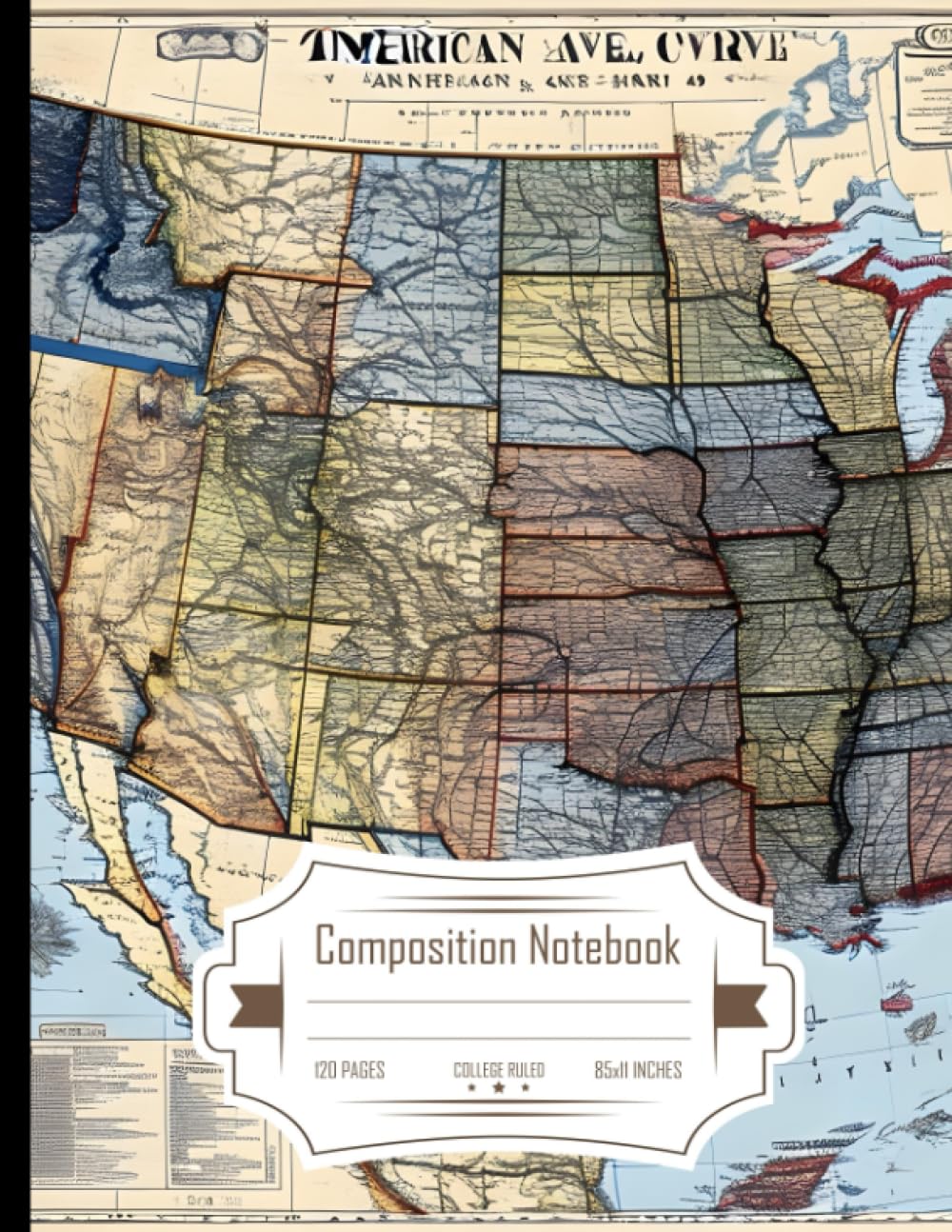
Composition Notebook College Ruled: American Civil War Map, Ideal for History Enthusiasts, Size 8.5x11 Inches, 120 Pages
Battle Maps of the Civil War: The Eastern Theater (Volume 1) (Maps from the American Battlefield Trust)
US and World Desk Map (13" x 18" Laminated) by American Geographics
Historical Atlas of Native Americans: 150 Maps Chronicle the Fascinating and Tragic Story of North America's Indigenous Peoples (Historical Atlases)
Larsen K17 North America Political Map Jigsaw Puzzle | 70 Pieces | Boxless Tray & Frame | Educational Geography Puzzle for Kids & Adults | Ideal for Learning About North America
Deep South - Zoom Map 177 (Michelin USA, 177) (Cover may vary)
World Map Poster for Wall – 84 x 60cm Large Wall Map of World – World Map Wall Art Atlas - Map of Europe Travel Map - Classroom or Geography Gift
Scratch Off Map UK | A2 Poster + Accessories Kit & Travel Poster Tube. Campervan Accessories UK Map for Day Trips. Travel Journal Wall Art. Nebula Watercolour Designed Scratch Off Poster
Colombia Map: Travel Maps International Adventure Map (National Geographic Adventure Travel Map South American)
laminated USA UNITED STATES AMERICA US map wall chart poster with FLAGS
American Flag Patch USA Map Shaped Embroidered Sew-on Iron-on Approximately 3.5 x 3 inch Beautiful Gift Materials Show Off Your Patriotic Spirit
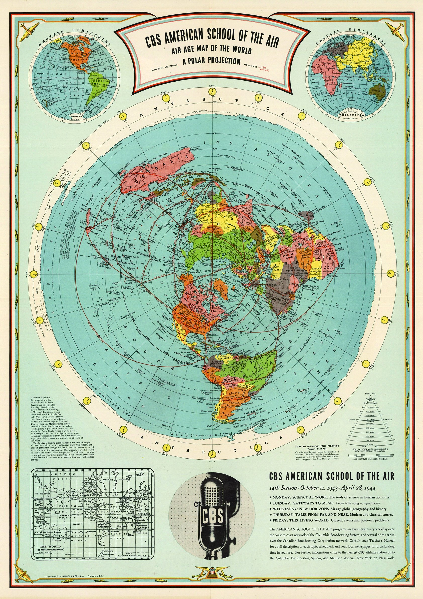
CBS American School of the Air | Map of the World Poster (Flat Earth) (A1 23.4 x 33.1 in)


![USA Map Poster - United States Map Chart [Green/Color]](https://m.media-amazon.com/images/I/91hlqXJIonS.jpg)


![2 Pack - World Map Poster & USA Map Chart [Tan/Color] (LAMINATED, 18” x 29”)](https://m.media-amazon.com/images/I/A1aLNThapcS.jpg)


![2 Pack - USA Map for Kids [Illustrated] + United States of America Map [Blue Ocean] (LAMINATED, 18" x 29")](https://m.media-amazon.com/images/I/A1Iz3w-oCUL.jpg)